Oct 24, 2024
Navigating the maritime logistics landscape requires precision, efficiency, and timely decision-making. One crucial tool that significantly enhances these aspects is a sea distance calculator. For shipowners and operators, accurately determining the nautical distances between ports can directly impact operational efficiency, fuel consumption, and overall profitability. In this blog, we will explore the vital role of sea distance calculators in maritime operations, the benefits they provide, and how solutions like ClearVoyage can streamline these processes.
Understanding Sea Distance Calculators
A sea distance calculator is a specialized tool that allows maritime professionals to measure the distance between two or more ports. By taking into account various factors such as currents, weather conditions, and geographical features, these calculators provide more accurate estimates than traditional methods. Whether you need a sea route calculator for planning a voyage or a cargo ship distance calculator to assess shipping costs, these tools play a pivotal role in modern shipping operations.

The Relevance of Sea Distance Calculators
Shipowners and operators face increasing pressure to optimize routes and reduce operational costs. In this context, a reliable sea distance calculator becomes invaluable. Understanding the sea freight distance not only helps in planning more efficient routes but also plays a critical role in calculating fuel consumption, estimating delivery times, and assessing overall profitability.

Key Aspects of Sea Distance Calculators
1. Accurate Measurement of Nautical Distances
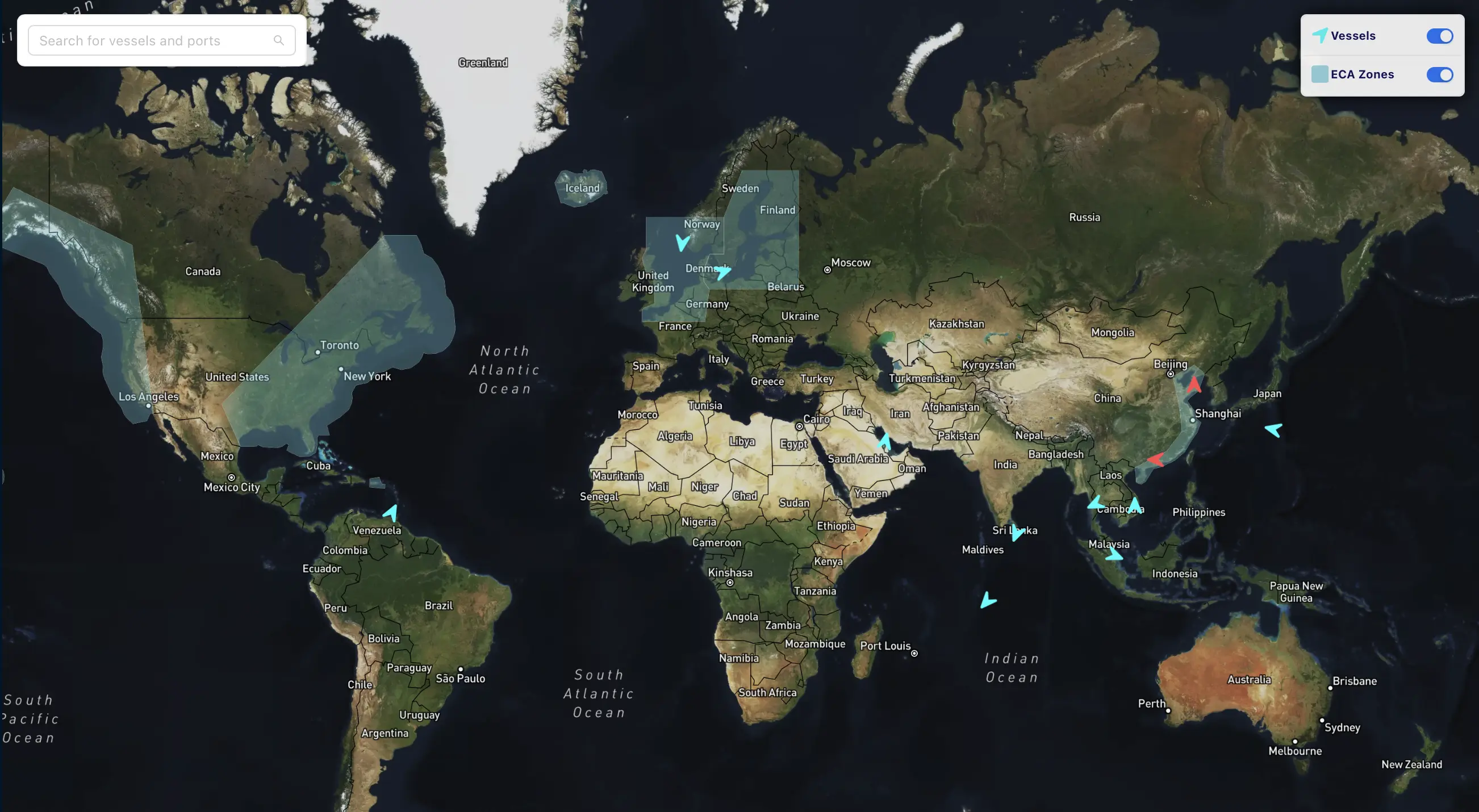
One of the primary functions of a nautical distance calculator map is to provide accurate measurements between various points on the globe. This accuracy is essential for several reasons:
Fuel Efficiency: Knowing the exact distance allows operators to calculate fuel needs more accurately, leading to significant cost savings. For instance, reducing even a small amount of distance can lead to a considerable decrease in fuel consumption over the course of a voyage, which can drastically reduce operational costs.
Time Management: By estimating travel times based on distance and speed, operators can provide better delivery estimates to clients. Accurate time management improves customer satisfaction and builds trust in your services.
Operational Planning: Accurate distance calculations enable more effective planning of logistics, ensuring timely arrivals and departures. This includes arranging for port services, crew shifts, and even scheduling future cargo bookings.
2. Enhanced Route Planning
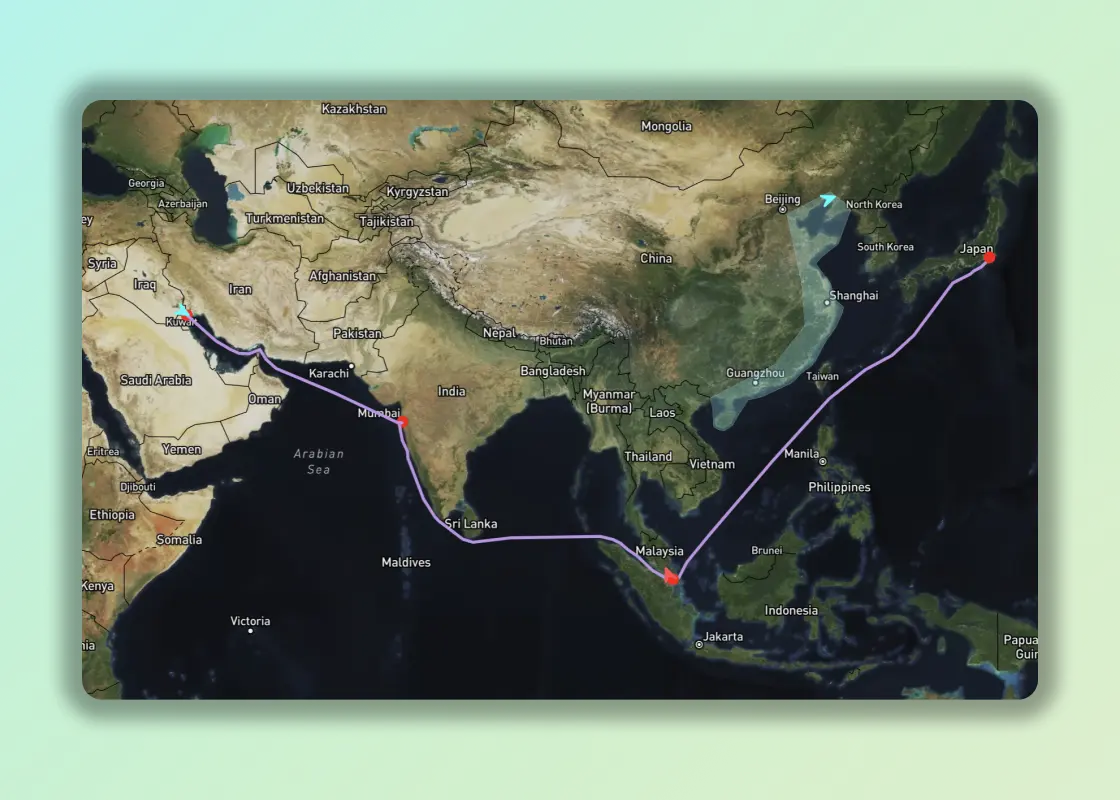
With a sea route calculator, shipowners can plan their journeys more effectively. These tools help identify the most efficient paths, taking into account:
Geographical Obstacles: The calculator can account for landmasses, reefs, and other obstacles that may affect the route. For example, avoiding certain routes during certain weather conditions can save ships from delays and additional costs.
Current and Weather Conditions: Advanced calculators integrate real-time data about currents and weather, allowing for adjustments that can save time and fuel. Being aware of adverse weather conditions ahead of time can help in planning alternate routes and avoiding delays.
Port Conditions: Knowing the conditions at destination ports helps in planning for possible delays or detours. Port congestion, maintenance schedules, or other operational delays can significantly affect delivery times and costs.

3. Cost Estimation for Shipping Operations
Understanding the distance table for various routes enables operators to estimate shipping costs accurately. The cost of fuel, port fees, and other expenses can be assessed more effectively when distances are known. A sea voyage calculatorcan also assist in:
Budgeting: Accurate distance calculations contribute to more precise budgeting for each voyage. By knowing the fuel consumption and expected delivery times, shipowners can create more effective budgets that account for all operational costs.
Quoting Clients: Providing precise estimates to clients based on accurate distances enhances customer satisfaction and trust. Accurate quotes prevent disputes over costs and timelines, fostering long-term client relationships.
4. Regulatory Compliance and Reporting
In today's highly regulated shipping environment, maintaining accurate records of distances traveled is crucial for compliance with various regulations. Sea distance calculators can facilitate this by:
Generating Reports: Many calculators can automatically generate reports based on distance traveled, fuel consumption, and other key metrics. This documentation is vital for audits and compliance with international shipping regulations.
Supporting Sustainability Initiatives: With increasing scrutiny on carbon emissions, accurate distance measurements can help in reporting and managing environmental impact. This is especially important as companies seek to align with international sustainability standards and regulations.
5. Integration with Other Maritime Tools
Modern sea distance calculators often integrate with other maritime software, enhancing their functionality and providing additional benefits:
Real-Time Tracking: When combined with tracking systems, distance calculators can provide real-time updates on a vessel’s position, allowing operators to adjust routes and schedules dynamically.
Data Analytics: Advanced systems offer analytics features that allow operators to review past voyages, assess efficiency, and identify areas for improvement. Insights drawn from this data can inform future decision-making and strategic planning.
User-Friendly Interfaces: Today’s maritime software solutions prioritize user experience, providing intuitive interfaces that simplify complex calculations. This accessibility allows shipowners and operators to make quick, informed decisions without needing extensive technical training.
Example of Calculating Sea Distance
Case Study 1: Optimizing Route Efficiency
A mid-sized shipping company operating between European and North American ports utilized a sea distance calculator to optimize its routes. By analyzing different routes, they identified a shorter path that reduced travel time by 20% and fuel consumption by 15%. This not only cut operational costs significantly but also allowed the company to offer more competitive rates to its customers. The success of this approach encouraged them to adopt further technological advancements, leading to a broader digital transformation within their operations.
Case Study 2: Improving Client Relations
Another company, focused on cargo transport, implemented a sea freight distance calculator that allowed them to provide precise delivery timelines to their clients. This tool integrated with their customer relationship management system, leading to a 30% increase in client satisfaction scores due to improved communication and reliability. By delivering on time and maintaining transparency about shipping durations, they solidified their reputation in a competitive market.
Case Study 3: Enhancing Sustainability
A global shipping firm seeking to reduce its carbon footprint utilized a nautical distance calculator map to assess and optimize its shipping routes. By implementing a strategy that focused on minimizing travel distances and fuel consumption, they achieved a 25% reduction in emissions over a year. This commitment to sustainability not only fulfilled regulatory requirements but also resonated positively with environmentally conscious clients, enhancing their brand image.
How ClearVoyage Can Help
ClearVoyage offers an integrated Voyage Management System (VMS) that features a powerful sea distance calculator. With ClearVoyage, shipowners and operators can easily:
Calculate Distances: Utilize the sea distance calculator to assess the nautical distances between ports with ease. This tool simplifies the calculation process, making it accessible even to those with limited technical expertise.
Optimize Routes: Leverage advanced analytics to plan optimal sea routes based on real-time conditions. The integration of weather and current data allows operators to adjust their plans proactively, mitigating potential disruptions.
Enhance Decision-Making: Access comprehensive data analytics to make informed decisions about voyage planning and operations. With detailed reports and insights, operators can evaluate past performance and refine future strategies.
Schedule a Demo
To see how ClearVoyage can transform your maritime operations, schedule a demo today. Experience firsthand how our tools can enhance your decision-making and improve your bottom line.
Conclusion
In an industry where time and cost are paramount, utilizing a sea distance calculator is not just a convenience; it's a necessity. By accurately determining the nautical distances between ports, optimizing routes, and improving cost estimation, shipowners and operators can significantly enhance their operational efficiency. With tools like ClearVoyage, you can streamline your maritime operations, ensuring your business stays competitive in a rapidly evolving market.
Key Takeaways
A sea distance calculator is essential for accurate route planning and operational efficiency.
Understanding the nautical distances between ports helps in budgeting and client communication.
For shipowners and operators looking to stay ahead of the competition, adopting these tools is a crucial step. Start optimizing your voyages today!
